Conde Nast Traveler magazine voted Charleston the top tourist town in the United States for 3 years running. Similar awards from Travel + Leisure and People's Choice Awards. Although we have visited Charleston a few times over the years the internet has made it easier to plan and choose from the many sights to see - I guess that makes us sightseers (grin).

Today the plan was park the car for the day in the city parking garage downtown. We then crossed the street to the Visitors Center to purchase our bus tour tickets.

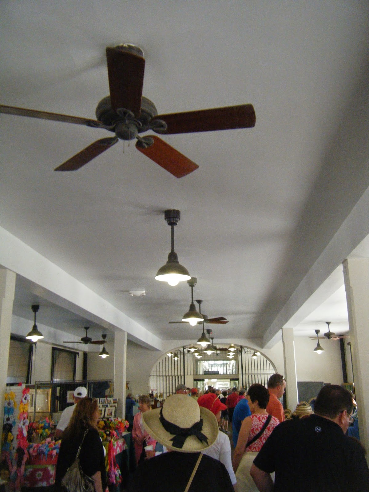
This visitor center was really well laid out. Charleston prides itself in restoring and re-purposing historic buildings. The center is in a former train station complex. The track area has now become the boarding area for the multitude of bus tour companies that serve Charleston.

Richard, our Tour Guide/Driver, had a friendly greeting as we arrived. Richard was excellent on the tour. His depth of knowledge and continuous easy manner by which he explained what we were seeing made the 90 minute tour fly by. There were so many interesting facts to relate them all would take - well - an hour and a half (to read).
From its settlement in 1670 until 1783, Charleston's development was almost entirely English, perhaps explaining why Charleston is not a "typical" Southern city, from either a social or architectural standpoint.
The most striking thing about Charleston is the cleanliness of the city and the beauty of the historic architecture. The predominate house style (in quantity) was the "Single House". Similar to a Philadelphia "Row House" or New Orleans "Shotgun House", it is both long and narrow.
Charleston was a walled fortress city between the years of 1690 and 1720, a period of constant danger from hostile French and Spanish invaders, Native American tribes, and pirates. Being a walled city, as many houses as were crowded onto a street as possible. As the city spread beyond the walls, this conservation of space became a habit - probably because it was crowded into a peninsula. - limiting land available. Charleston was one of four walled cities in North America, and the only English walled city on the continent. (French - Quebec City, QC Canada; Spanish - St. Augustine, FL USA and San Francisco de Campeche, Campeche, Mexico). Charleston's wall (12 feet high) was built in 1703 as a response to fear of the French, the Spanish and the Native Americans.

The house is well-suited to long, narrow lots which were laid out in early Charleston. A single house has its narrow side with a gable end along the street and a longer side running perpendicular to the street. Although the form can be found across historic Charleston in a variety of styles (e.g., Federal, Greek Revival, and Victorian), the consistent feature is the interior layout. A front door on the long side of the house, half way along the side perpendicular to the street, opens onto a short central hall and staircase. There is one room on each side of the hall, that is, one toward the street and one toward the rear of the house. The result is a building which is only one room wide when viewed from the street, giving the form its popular name. Each floor contained two rooms, and the floorplan was reproduced on each floor above.

Although not a part of the earliest single houses, later buildings had two and three story porches, known locally as piazzas, added. The piazzas always appear on the side of the house with the front door which, to take best advantage of local winds, will be the south or west side.

Service areas were often located in separate buildings behind the house. This was for a number of reasons. The services (kitchen) had a fire (for cooking) that was on all day - even in the summer. Being separate kept the house cooler.

There was also the fear of fire. Many of these houses were wooden and most, being very close together, increased the spread of fire should one occur. Being at the rear lessened the chance of a kitchen fire taking out the main building and several of the neighbours, as well. After childbirth, kitchen fires were the leading cause of death for women in Charleston in this era.

The more affluent lived in a "Double House" which faced the street at full-length. The main characteristic of this type of architecture is that there is a central entrance hallway running through the house. Living rooms, drawing rooms, and other living areas are usually on either side downstairs, and the bedrooms are upstairs. They also have piazzas like Single Houses.

The "English" influence caused an unusual style adaptation in Charleston. To imitate the architecture of the desired "London (UK) House" of the era; many houses were modified to look like the stone block houses of that city. Brick houses had stucco applied and carved to look like blocks. In some cases, the wood itself was "carved" to look like blocks, as well.

Note: Charleston is built on an earthquake fault line area. The "White" area is a "Lion" decoration covering an earthquake plate. A bolt that ran the length of the house between the floor joists was secured through a plate on the house exterior adding stability to masonry houses. The wooden houses could flex more during the "Shake".


Today the plan was park the car for the day in the city parking garage downtown. We then crossed the street to the Visitors Center to purchase our bus tour tickets.
This visitor center was really well laid out. Charleston prides itself in restoring and re-purposing historic buildings. The center is in a former train station complex. The track area has now become the boarding area for the multitude of bus tour companies that serve Charleston.
Richard, our Tour Guide/Driver, had a friendly greeting as we arrived. Richard was excellent on the tour. His depth of knowledge and continuous easy manner by which he explained what we were seeing made the 90 minute tour fly by. There were so many interesting facts to relate them all would take - well - an hour and a half (to read).
From its settlement in 1670 until 1783, Charleston's development was almost entirely English, perhaps explaining why Charleston is not a "typical" Southern city, from either a social or architectural standpoint.
The most striking thing about Charleston is the cleanliness of the city and the beauty of the historic architecture. The predominate house style (in quantity) was the "Single House". Similar to a Philadelphia "Row House" or New Orleans "Shotgun House", it is both long and narrow.
Charleston was a walled fortress city between the years of 1690 and 1720, a period of constant danger from hostile French and Spanish invaders, Native American tribes, and pirates. Being a walled city, as many houses as were crowded onto a street as possible. As the city spread beyond the walls, this conservation of space became a habit - probably because it was crowded into a peninsula. - limiting land available. Charleston was one of four walled cities in North America, and the only English walled city on the continent. (French - Quebec City, QC Canada; Spanish - St. Augustine, FL USA and San Francisco de Campeche, Campeche, Mexico). Charleston's wall (12 feet high) was built in 1703 as a response to fear of the French, the Spanish and the Native Americans.
The house is well-suited to long, narrow lots which were laid out in early Charleston. A single house has its narrow side with a gable end along the street and a longer side running perpendicular to the street. Although the form can be found across historic Charleston in a variety of styles (e.g., Federal, Greek Revival, and Victorian), the consistent feature is the interior layout. A front door on the long side of the house, half way along the side perpendicular to the street, opens onto a short central hall and staircase. There is one room on each side of the hall, that is, one toward the street and one toward the rear of the house. The result is a building which is only one room wide when viewed from the street, giving the form its popular name. Each floor contained two rooms, and the floorplan was reproduced on each floor above.
Although not a part of the earliest single houses, later buildings had two and three story porches, known locally as piazzas, added. The piazzas always appear on the side of the house with the front door which, to take best advantage of local winds, will be the south or west side.
Service areas were often located in separate buildings behind the house. This was for a number of reasons. The services (kitchen) had a fire (for cooking) that was on all day - even in the summer. Being separate kept the house cooler.
There was also the fear of fire. Many of these houses were wooden and most, being very close together, increased the spread of fire should one occur. Being at the rear lessened the chance of a kitchen fire taking out the main building and several of the neighbours, as well. After childbirth, kitchen fires were the leading cause of death for women in Charleston in this era.
The more affluent lived in a "Double House" which faced the street at full-length. The main characteristic of this type of architecture is that there is a central entrance hallway running through the house. Living rooms, drawing rooms, and other living areas are usually on either side downstairs, and the bedrooms are upstairs. They also have piazzas like Single Houses.
Note: Charleston is built on an earthquake fault line area. The "White" area is a "Lion" decoration covering an earthquake plate. A bolt that ran the length of the house between the floor joists was secured through a plate on the house exterior adding stability to masonry houses. The wooden houses could flex more during the "Shake".
Another note: The staircase on the front of the house, known as a welcoming-arms staircase, according to Legend, was created to allow men to walked up the right side of the staircase and the women the left, the theory being that if you saw a lady's ankle you would have to marry her. The probable reason was that Women of that period were known to wear bodices that left ample bosoms open to the naked eye. This arrangement avoided the obvious problem.
Still another note: Many think the cupola perched on many of the rooftops was a widow's walk where wives were able to look out to sea while they waited for their husbands, but actually it’s a form of air conditioning. If you open all the windows of the house, then open the windows of the cupola the cooler air is drawn in onthe bottom floors while the warm air escaped through the cupola.
This is a city I know our friends from Mexico (Alberto and Diane) would really enjoy visiting. Alberto is an architect and during today's tour we saw a wide variety of really beautiful and interesting architecture. This is one of the reasons Charleston was voted #1 for tourists.
OK - another note: Broad Street, in the past, was considered the dividing line between the affluent and the less well to do folks. The affluent, South Of Broad - were called SOB's. Those to the North were SNOB's (Slightly North of Broad) (grin).
Our tour also took us to the seawall near "The Battery". The Battery is the defensive seawall and promenade named for a civil-war coastal defense artillery battery at the site. that stretched along the lower shores of the Charleston peninsula, bordered by the Ashley and Cooper Rivers, which meet to form Charleston harbour.
Needless to say there was quite a breeze on the seawall.
Richard started his presentation on the seawall; however, due to the wind we returned to the bus to finish his information session. (I'm guessing he must have been a History major?)
Yes - still another note: Much of Charleston near the seawall today did not exist during the city's original formative years. A network of seawalls constructed of tabby, a locally made mixture of crushed oyster shells, sand and lime based mortar, was constructed in the 18th and 19th century along the Charleston waterfront. This system of seawalls was constructed to protect residents from flooding which was common prior to the extension of the Battery in the early 20th century.
OK - final note: Charleston is also known as "The Holy City" due to the high concentration of churches in town - including the only "French Huguenot" in North America. I don't know the "Church Count" in Charleston. I wonder if it rivals Puebla, Mexico, which we visited with Diane and Alberto? Puebla has 70 churches in the historic center alone,
There were lots of points of interest detailed by Richard. Originally known as "Cow Alley" this lane was renamed “Philadelphia Alley”. Opinions vary as to the reasons why this name change came about; some say it was due to the citizens of Philadelphia helping Charleston rebuild after a fire. Others say it was because Johnson had been imprisoned in Philadelphia during the Revolutionary War, and named it in honor of the connections he had made there. Whatever the story, locals have a more colorful name for this elegantly landscaped thoroughfare. Today, most Charlestonians simply call the cobblestone passage “Dueler’s Alley.”
By sword or pistol, dueling was considered a gentleman’s way of settling disputes of honor. It began in the Middle Ages and was imported from Europe with American colonization. By the time of the late Colonial and Revolutionary periods, dueling was all the rage in America, culminating with the most famous duel of all in Weehawken, New Jersey, when Aaron Burr killed Alexander Hamilton in a duel on July 11, 1804. Soon outlawed, it remained popular in the South until well past the 1840's, often held on sandbars in rivers where jurisdiction was unclear. This alley was an ideal place to duel due to the high walls on either side.
It is said that Philadelphia Alley still carries the sounds of pistol shots and the smell of gunsmoke. Ghostly visions of ladies in gowns appear on photographs, as do shadows and violet fire. Some visitors are said to experience time loops. Considered to be the most haunted lane in Charleston, there are rumors of over thirty recorded deaths here.
(Maybe next visit we will take a Ghost Tour?).
On our return to the Visitors center at the end of the tour we boarded the (Free) Trolley - Route 211 which took us down to the Charleston City Market.
Established in the 1790's, the market stretches for four city blocks from Market Hall (on National Register of Historic Places), which faces Meeting Street, through a continuous series of one-story market sheds, the last of which terminates at East Bay Street. The top floor of the main entrance is a Confederate Museum.
Strolling through the Market we encountered a wide assortment of vendors selling high quality products including paintings, pottery, and Gullah foodstuffs, as well as spots for casual dining and more!
Charleston's famous Gullah sweetgrass baskets were everywhere. The cost was astronomical with the largest baskets being hundreds of dollars.
The Gullah are the descendants of enslaved Africans who live in the Lowcountry region of the US (SC and GA). The Gullah people and their language (also called Geechee, speculated to relate to the Ogeechee River near Savannah, GA. "Gullah" (originally used to designate the variety of English spoken) over time has come to be used by its speakers to formally refer to their creole language and distinctive ethnic identity.

We were getting a little hungry. Today we went to the Charleston Crab House. Family Owned for 20 Years they specialize in fresh Lowcountry seafood served in a casual, family friendly atmosphere. Indoor and outdoor seating is offered. We were lucky enough to get a table on the roof patio.

Our choice today was a large Dinner Salad: Mixed greens, tomatoes, cucumber, mixed cheeses, diced bacon, red onion and croutons . We chose the Blue Cheese dressing. It was fresh and really good.
The main course was the Lowcountry Shrimp Boil: with corn, potatoes, shrimp and andouille sausage. It was really tasty. it also came with a serving of "Hush Puppies" aka Southern Tim-Bits.

After the meal, on the way to the Trolley Stop, we tried a "Praline Sample". Good; but, not even close to the Pralines we always buy when in New Orleans - so we passed.
We then got on the Trolley and returned to the Visitor Center. The last mission before going to the car in the parking garage was to take a photo of the H.L. Hunley. this is a re-production at the Charleston Museum that was constructed from the known information at the time.

H. L. Hunley was a submarine of the Confederate States of America that played a small part in the American Civil War. Hunley demonstrated the advantages and the dangers of undersea warfare. She was the first combat submarine to sink a warship, although Hunley was not completely submerged and, following her successful attack, was lost along with her crew before she could return to her base.
The Confederacy lost 21 crewmen in three sinkings of Hunley during her short career. The submarine was named for her inventor, Horace Lawson Hunley, shortly after she was taken into service under the control of the Confederate Army at Charleston, SC.
Hunley, nearly 40 feet long, was built at Mobile, Alabama, and launched in July 1863. She was then shipped by rail on August 12, 1863 to Charleston, SC. Hunley sank on August 29, 1863, during a training exercise, killing five members of her crew. She sank again on October 15, 1863, killing all eight of her second crew, including Horace Hunley himself. Both times Hunley was raised and returned to service. On February 17, 1864, Hunley attacked and sank the USS Housatonic which was on Union blockade duty in Charleston's outer harbor. Soon after, Hunley sank, killing all eight of her third crew. This time, the innovative ship was lost.
Finally located in 1995, Hunley was recovered in 2000. Examination in 2012 of recovered Hunley artifacts suggests that the submarine was as close as 20 feet to her target, Housatonic, when her deployed torpedo exploded, which eventually caused the sub's own demise.
Unfortunately, it is on display elsewhere in Charleston; however, it is only available for viewing on Saturday and Sunday (we will be gone). The weekdays are used for restoration work. Maybe next time? The Hunley crewmen, when they are ultimately laid to rest at Magnolia Cemetery, will be honour as real men, with names and faces, due to the forensic facial reconstruction that is now being done.
Rush hour traffic added 10 minutes to return time to the RV Park. No real problems - just the additional volume meant we had to stop for a lot more traffic lights.
It was another very interesting and full day in Charleston, SC.
We were getting a little hungry. Today we went to the Charleston Crab House. Family Owned for 20 Years they specialize in fresh Lowcountry seafood served in a casual, family friendly atmosphere. Indoor and outdoor seating is offered. We were lucky enough to get a table on the roof patio.
Our choice today was a large Dinner Salad: Mixed greens, tomatoes, cucumber, mixed cheeses, diced bacon, red onion and croutons . We chose the Blue Cheese dressing. It was fresh and really good.
The main course was the Lowcountry Shrimp Boil: with corn, potatoes, shrimp and andouille sausage. It was really tasty. it also came with a serving of "Hush Puppies" aka Southern Tim-Bits.
After the meal, on the way to the Trolley Stop, we tried a "Praline Sample". Good; but, not even close to the Pralines we always buy when in New Orleans - so we passed.
We then got on the Trolley and returned to the Visitor Center. The last mission before going to the car in the parking garage was to take a photo of the H.L. Hunley. this is a re-production at the Charleston Museum that was constructed from the known information at the time.
H. L. Hunley was a submarine of the Confederate States of America that played a small part in the American Civil War. Hunley demonstrated the advantages and the dangers of undersea warfare. She was the first combat submarine to sink a warship, although Hunley was not completely submerged and, following her successful attack, was lost along with her crew before she could return to her base.
The Confederacy lost 21 crewmen in three sinkings of Hunley during her short career. The submarine was named for her inventor, Horace Lawson Hunley, shortly after she was taken into service under the control of the Confederate Army at Charleston, SC.
Hunley, nearly 40 feet long, was built at Mobile, Alabama, and launched in July 1863. She was then shipped by rail on August 12, 1863 to Charleston, SC. Hunley sank on August 29, 1863, during a training exercise, killing five members of her crew. She sank again on October 15, 1863, killing all eight of her second crew, including Horace Hunley himself. Both times Hunley was raised and returned to service. On February 17, 1864, Hunley attacked and sank the USS Housatonic which was on Union blockade duty in Charleston's outer harbor. Soon after, Hunley sank, killing all eight of her third crew. This time, the innovative ship was lost.
Finally located in 1995, Hunley was recovered in 2000. Examination in 2012 of recovered Hunley artifacts suggests that the submarine was as close as 20 feet to her target, Housatonic, when her deployed torpedo exploded, which eventually caused the sub's own demise.
Unfortunately, it is on display elsewhere in Charleston; however, it is only available for viewing on Saturday and Sunday (we will be gone). The weekdays are used for restoration work. Maybe next time? The Hunley crewmen, when they are ultimately laid to rest at Magnolia Cemetery, will be honour as real men, with names and faces, due to the forensic facial reconstruction that is now being done.
Rush hour traffic added 10 minutes to return time to the RV Park. No real problems - just the additional volume meant we had to stop for a lot more traffic lights.
It was another very interesting and full day in Charleston, SC.
No comments:
Post a Comment